UN
Meadows
£ 670,000
Description
We don't have a Description for this property.
- Bedrooms
- 4
- Bathrooms
- 0
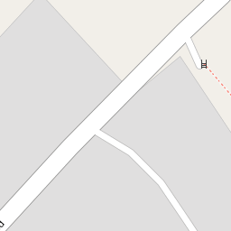


Leaflet © OpenStreetMap contributors
The heatmap indicates the level of crime in the area. The color of the heatmap indicates the crime severity and recency.
Metrics Year-on-Year
- Average area value
- 278,019.00 £Increased by 21.15 %
- Average area rental value
- 919.00 £/moDecreased by 8.01 %
- Est rental Yield
- 3.97 %Decreased by 23.95 %
- Crime Rate
- 0.00 %
from 229,480.00 £
from 999.00 £/mo
from 5.22 %
from 0.00 %
Nearby Schools
| Name | Type | Ofsted | Distance |
|---|---|---|---|
| Smeeth Community Primary School | Foundation School | Requires improvement | 0.73 KM |
| Caldecott Foundation School | Non-maintained Special School | Good | 1.02 KM |
| Brabourne Church Of England Primary School | Voluntary Controlled School | Good | 3.60 KM |
| Aldington Primary School | Foundation School | Good | 3.60 KM |
| Mersham Primary School | Foundation School | Good | 3.62 KM |
Images
Nearby Streets
| Name | Average Price | Average Sqft | Distance |
|---|---|---|---|
| The Chestnuts | £ 430,000 | 0 | 0.00 KM |
Nearby Transport
| Name | NLC | TLC | Distance |
|---|---|---|---|
| Wye | 5031 | WYE | 8.10 KM |
| Westenhanger | 5030 | WHA | 8.95 KM |
| Ashford International | 5004 | AFK | 9.76 KM |
Nearby Listings
| Address | Price | Type | Score | Distance |
|---|---|---|---|---|
| The Ridgeway, Ashford, Kent, TN25 | £ 495,000 | BUY | 6 / 10 | 0.32 KM |
| The Ridgeway, Smeeth, TN25 6SD | £ 600,000 | BUY | Unknown | 0.32 KM |
| The Ridgeway, Smeeth, TN25 | £ 315,000 | BUY | 7 / 10 | 0.33 KM |
| Church Road, Brabourne Lees | £ 500,000 | BUY | 7 / 10 | 0.56 KM |
| The Chestnuts, Smeeth, Ashford, Kent TN25 | £ 375,000 | BUY | 5 / 10 | 0.71 KM |
Nearby Properties
| Address | Price | Distance |
|---|---|---|
| Church Green Cottage | £ 550,000 | 0.00 KM |
| Walnut Tree Farm | £ 350,000 | 0.00 KM |
| Meadows | £ 670,000 | 0.00 KM |
| Mead House | £ 445,000 | 0.00 KM |
| Walnut Tree Farmhouse | £ 420,000 | 0.00 KM |